North Somerset Council is looking for additional sites to meet the government’s new higher housing target for the district of 23,805 new homes over 15 years.
The council will be assessing potential locations for new development using the following hierarchy:
- Development that maximises urban capacity, focusing on previously developed land and reviewing densities.
- Development at the towns (outside the Green Belt).
- Development at the larger, most sustainable villages (outside the Green Belt).
- Development in the ‘Grey Belt’ in sustainable locations. The government defines the Grey Belt as Green Belt which is either brownfield or makes a limited contribution to Green Belt purposes. The council is reviewing the Green Belt in North Somerset to identify which areas meet this definition.
- Development in the Green Belt adjacent to Bristol and at the towns.
- Development in the Green Belt at the larger, most sustainable villages.
North Somerset Council preparing updated Local Plan
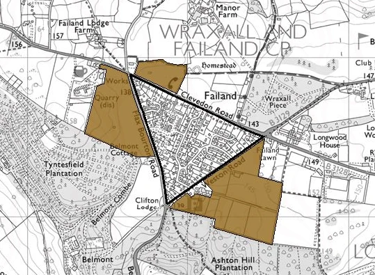
Strategic Housing Land Availability Assessment (SHLAA) map
The fields around Failand are low in the hierarchy but not safe because sites higher up may be unsuitable for reasons such as poor road links. They also risk being classified as Grey Belt.